
Remembering YAH · Continuing study
D’Anville / Bolton / Bowen: Africa
Follow the archive record for the multi-sheet map discussed with the Lamlem, Falasjam and coastal place-name inquiry. Inspect the record and full image together.
Map · 1774 catalog lead
The record
Follow the archive record for the multi-sheet map discussed with the Lamlem, Falasjam and coastal place-name inquiry. Inspect the record and full image together.
Yale University Library · catalog 15512964
Open Yale map record ↗What to examine
BHITB labels its exhibit 1774; its reproduced image filename identifies 1766. The precise edition of that reproduction remains unresolved in the book.
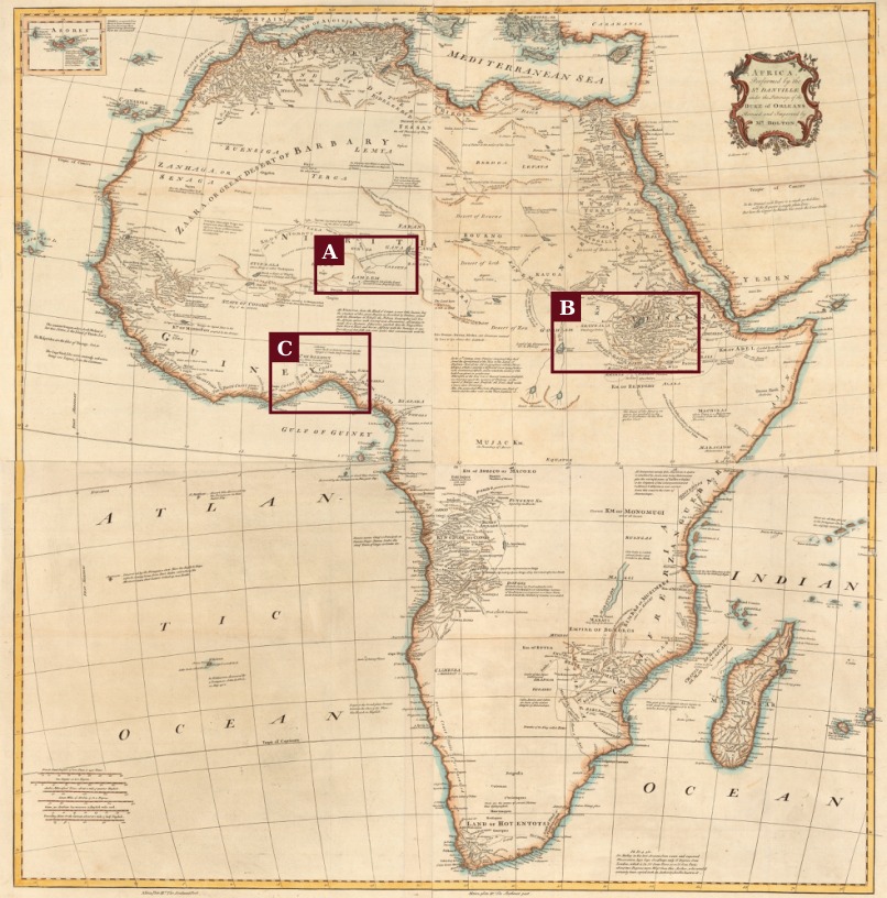


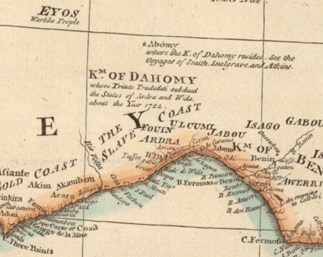
Edition comparison: 1774 and 1794
The David Rumsey collection independently catalogs a 1774 composite Africa map, plates I–IV, list number 13171.011. Its record identifies a four-sheet composition with pictorial relief and assigns it to the fourth edition of Postlethwayt’s trade dictionary. This is a comparison record; it does not establish the precise edition of the reproduced image above.
Open the 1774 Rumsey record ↗A separate Library of Congress record dates its Boulton map to 1794 and traces its model to d’Anville’s 1749 map. Do not merge that later record with the 1774 catalog entry.
Open the 1794 Library of Congress record ↗Make your own source record
- Identify the creator, title, edition and date from the source itself.
- Record the exact page or map sheet. Read the surrounding passage or full geographical setting.
- Separate the wording visible in the document from the interpretation you draw from it.
- Keep unresolved readings and conflicting dates in your notes so the comparison can be revisited.
Research trail
Credit for the linked discovery trail remains with its creator. This exhibit organizes the source record and study questions.
Read the credited presentation ↗Exhibit assembled October 20, 2026. Catalog leads and unresolved edition details are identified above; this page does not supply a new transcription of the linked work.